- GPS (Latitude and Longitude)
- Cross Bearings
- Ranges of Two or More Points.
- Combined Range and Bearing.
- A Bearing and Sounding
- Running Fix.
- Doubling the Angle on the Bow.
- The Four Point Bearing.
- The Transit Bearing.
- Danger or Clearing Bearings.
- Vertical Sextant Angle.
- By Astronomical object.
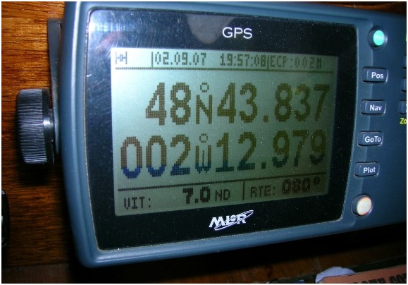
GPS (Latitude and Longitude)
This is the obvious one! Switch it on, and in a few seconds your position will be displayed as a Latitude and Longitude. Remember the default datum is WGS84, check the datum menu if your not sure.
Cross Bearings
Bearings taken may be:
- Relative – as with pelorus or radar in ship’s head up display.
- Compass – using the magnetic compass
- Gyro – when a gyro repeater is used.
In any case the bearing must be converted to true before laying it off on the chart.
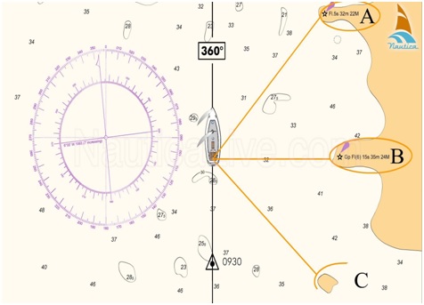
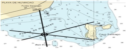
Each position line (LOP) should be identified by a single arrow at the end of the line away from the object observed. When position lines intercept at (or nearly at) a point, that point should be encircled and the time of the fix noted alongside.
When position lines fail to intercept at a point and a “cocked hat” results, it may be due to any of the following:
- Too long a delay between taking bearings
- Wrong identification of an object
- Error in plotting
- Compass error wrongly applied
- Unknown compass error
- Poor survey of the area
Ranges of Two or More Points
This is the preferred method when fixing the position by radar observations. Ranges taken from the radar are generally more accurate than radar bearings. Avoiding the steps necessary to convert relative or compass bearings to true also reduces the chance of error.
Ranges must be taken off the adjacent latitude scale and the relevant arc plotted on the chart using compasses. Both ends of the arcs should be marked with a single arrow, the point of intersection circled, and the time of the fix written alongside.
Selection of objects for ranges is as important as it is with bearings, and any cocked hat should be treated in much the same way.