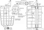
CONTOUR SEARCH (OS)
- Used around mountains and in valleys when sharp changes in elevation make other patterns not practical.
- Search is started from highest peak and goes from top to bottom with new search altitude for each circuit.
- Search altitude intervals may be 150 m to 300 m (500 ft to 1,000 ft).
- The aircraft may make a descending orbit away from the mountain before resuming the contour search at the lower altitude.
- The aircraft may spiral downwards around the mountain at a low but approximately constant rate of descent when there is not enough room to make a circuit opposite to the direction of search.
- If the mountain cannot be circled, successive sweeps at the same altitude intervals as listed above should be flown along its side.
- Valleys are searched in circles, moving the centre of the circuit one track spacing after each completed circuit.


What is “S” stands for in expanding square search
Which search to be carried out if time elapsed of 4 hrs. Thanks and best rgds
I’m a mariner ,my English is not strong . Please explain navigation in Hindi too.Your effort will help north indian mariners to help navigation easily.
Thanks in advance
i can explain in hindi please do call me on 7000722606
you are just too good. this is a welcome development.
your site is helping Mariners all over the world.
thanks
How is the initial distance between legs determined in an expanding square search?