Clouds are formed in four main ways:
- Turbulence
- Orographic lifting
- Convention
- Frontal lifting
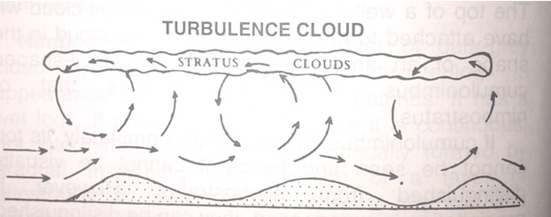
Turbulence
Strong winds blowing over uneven strike against the various obstructions and the air get deflected upwards. This causes thorough mixing of the air and as the air rises it cools adiabatically. If during the process, the air gets cooled below its dew point, clouds will form. These clouds will be of an even, layer type (stratus) and their bases will generally be not more than 600m high. Turbulence clouds will be formed in great quantities of the air is maritime (moisture laden) and blows over cold, uneven ground. Over sea, wind speeds of more than 13 knots only ( force 4 and over) can produce sea waves of sufficient height to create turbulence clouds.