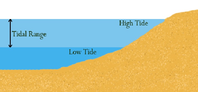
Tidal Range Whether a tide is neap or spring (or an intermediate) is determined not by the height of high water but by the difference between the height of high water and the next (or preceding) low water. This is called the...
Tidal Range Whether a tide is neap or spring (or an intermediate) is determined not by the height of high water but by the difference between the height of high water and the next (or preceding) low water. This is called the...
Cross Bearings Ranges of Two or More Points. Combined Range and Bearing. A Bearing and Sounding Running Fix. Doubling the Angle on the Bow. The Four Point Bearing. The Transit Bearing. Danger or Clearing Bearings. Vertical...
By Astronomical object. A Bearing and Sounding Running Fix. By Astronomical object Six common methods are used : Latitude by Polaris (Pole Star) Latitude by meridian altitude Latitude by ex-meridian Longitude by meridian passage...