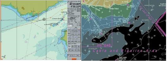
- Unlike ECDIS where there are no chart boundaries, RCDS is a chart-based system similar to a portfolio of paper charts;
- Raster navigational chart (RNC) data, itself, will not trigger automatic alarms (e.g. anti-grounding). However, some alarms can be generated by the RCDS from user-inserted information. These can include:
- Clearing lines
- Ship safety contour lines
- Isolated dangers
- Danger areas
- Horizontal datums and chart projections may differ between RNCs. Mariners should understand how the chart horizontal datum relates to the datum of the position fixing system. In some instances, this may appear as a shift in position. This difference may be most noticeable at grid intersections and during route monitoring;
- Chart features cannot be simplified or removed to suit a particular navigational circumstance or task at hand. This could affect the superimposition of radar/ARPA;
- Without selecting different scale charts, the look-ahead capability may be somewhat limited. This may lead to some inconvenience when determining range and bearing or the identity of distant objects;
- Orientation of the RCDS display to other than chart-up, may affect the readability of chart text and symbols (e.g., course-up, route-up);
- It may not be possible to interrogate RNC features to gain additional information about charted objects;
- It is not possible to display a ship’s safety contour or safety depth and highlight it on the display, unless these features are manually entered during route planning;
- Depending on the source of the RNC, different colours may be used to show similar chart information. There may also be differences in colours used during day and night time;
- In RNC should be displayed at the scale of the paper chart. Excessive zooming in or zooming out can seriously degrade RCDS capability, for example, by degrading the legibility of the chart image; and
- Mariners should be aware that in confined waters, the accuracy of chart data (i.e., paper charts, ENC or RNC data) may be less than that of the position-fixing system in use. This may be the case when using differential GNSS. ECDIS provides an indication in the ENC which allows a determination of the quality of the data.


