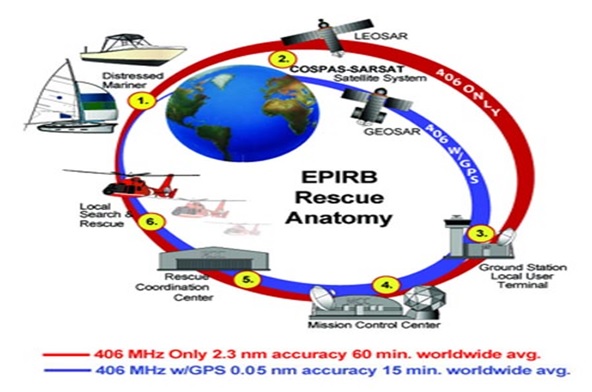
The location of the distress signal is determined by taking measurements of the doppler shift of the EPIRB frequency when the satellite first approach and then pass the EPIRB. The actual frequency is heard at the time of closest approach (TCA). Knowing the position of the satellite and using the received doppler signal information, it is possible to determine the location of the EPIRB from the satellite at the TCA. At the LUT, actually two positions are calculated. One is the actual position (A) and the other is the mirror image (B) position. A second satellite pass confirms the correct location (A). With the 406 system the real solution can be determined on the first pass with a reliability of nearly 90% and down to an accuracy of less than 5 km (3.1 miles).

Leave a Comment